Some Maps in Napoléon vu par Abel Gance (1927)
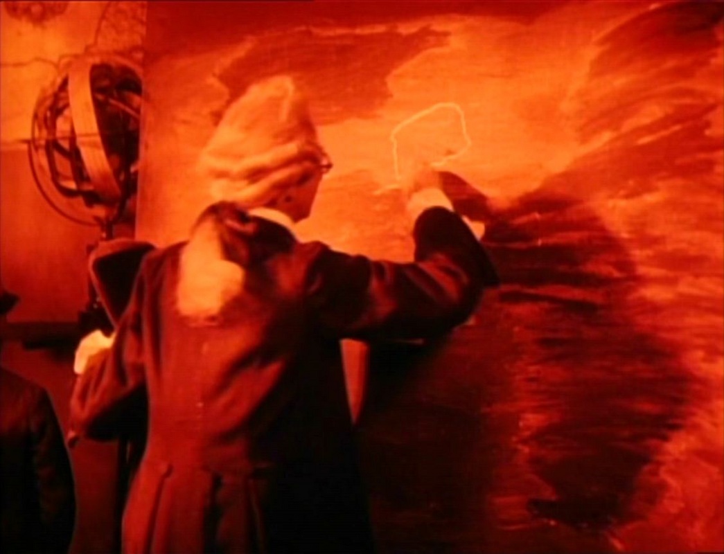
Both near the beginning and at the very end of Gance’s Napoleon are sequences where maps combine to configure key meanings of the film. The first, twelve minutes in, is a school geography lesson on the climate of islands. In a classroom full of maps, the teacher points first to one blackboard on which he has drawn Sicily and Malta and then to another on which he has drawn Cyprus, Crete and Madagascar:
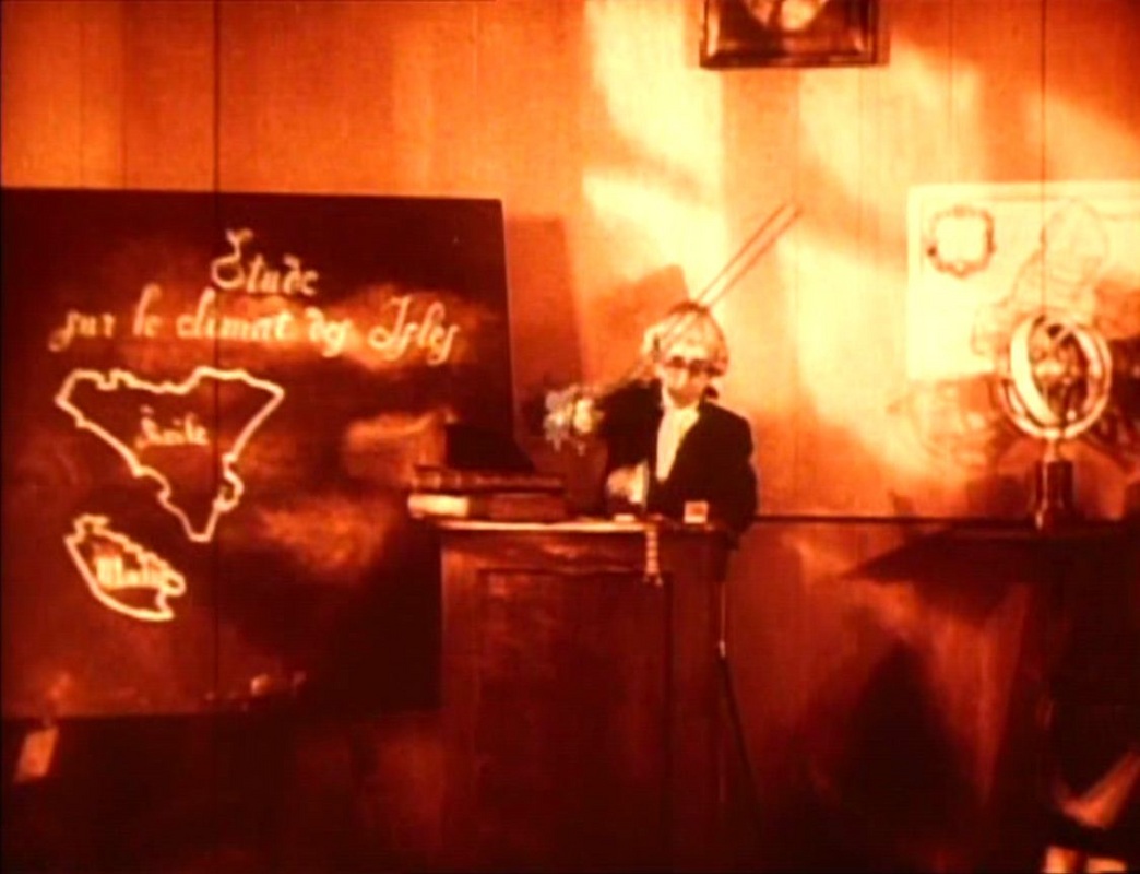
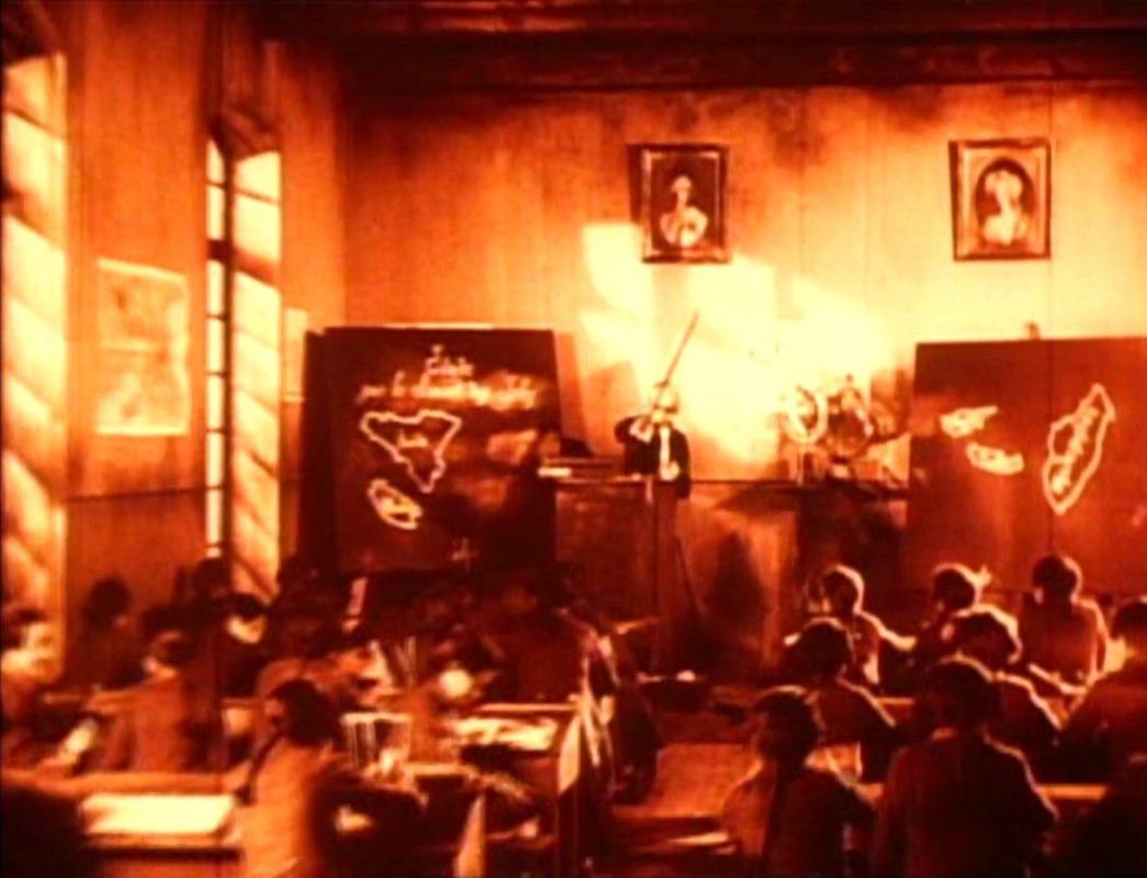
On both boards the maps are positioned without respect for topographical exactitude. The lesson proceeds with the teacher rubbing Sicily and Malta from the left hand board and drawing another map, of which he says: ‘And as for Corsica, that half-civilised island…’.
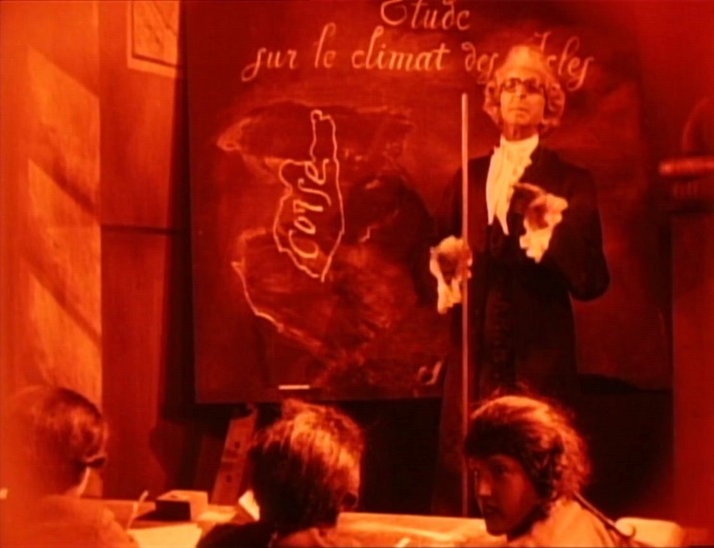
To this denigrating description a child in the class responds angrily. The scene serves to signal the young Bonaparte’s pride and temper, but though the provocation of such a response is the principal narrative purpose here, for a reader of maps in films there are other things to note. The teacher replaces the two islands on the first board with a solitary island, emblematic of Bonaparte’s isolation, a Corsican among the French. (In a later sequence we see that Bonaparte has on his wall a map of solitary Corsica as reminder of his isolation.)
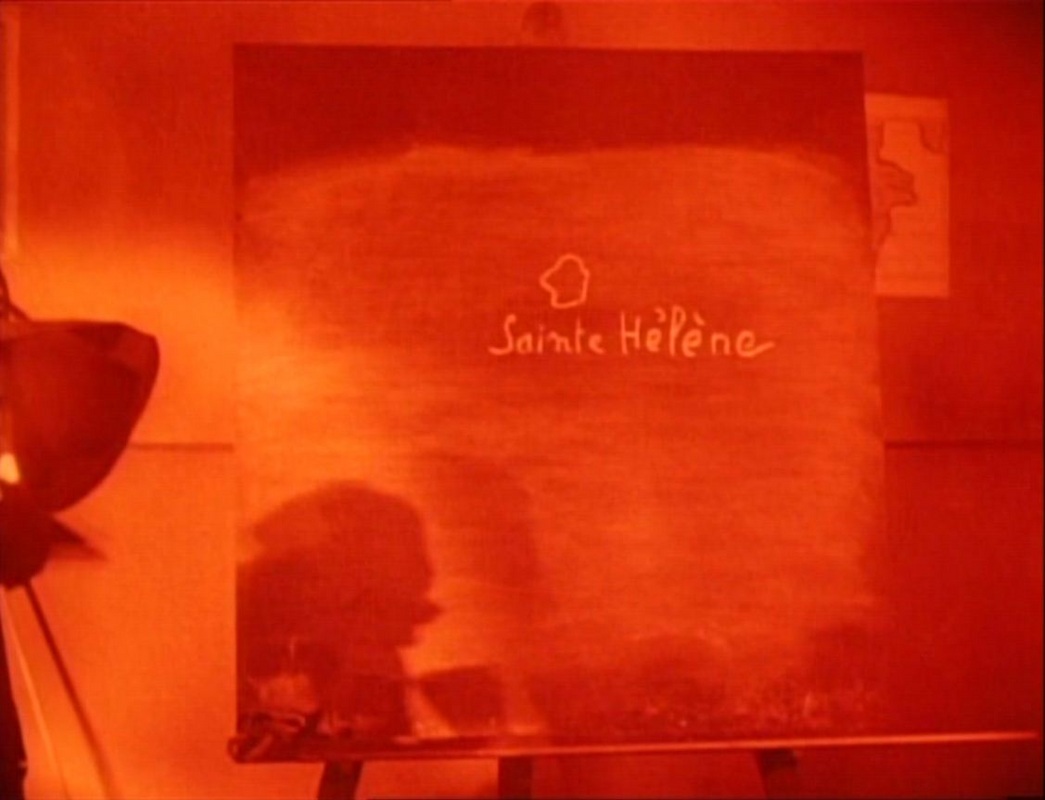
The three islands on the other board are, in conclusion to the lesson, also effaced and replaced with a solitary ‘little island lost in the ocean…’: Saint Helena.
The topographical disorder of the teacher’s mapping is subsumed by the larger narrative purpose, taking us beyond the end point of Gance’s film – which climaxes on the first Italian campaign – to the end point of Bonaparte's story: his exile and death. And all this work is done by the simple line drawing of a map on a blackboard:
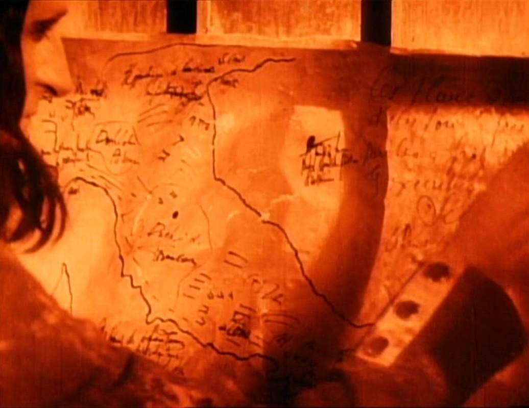
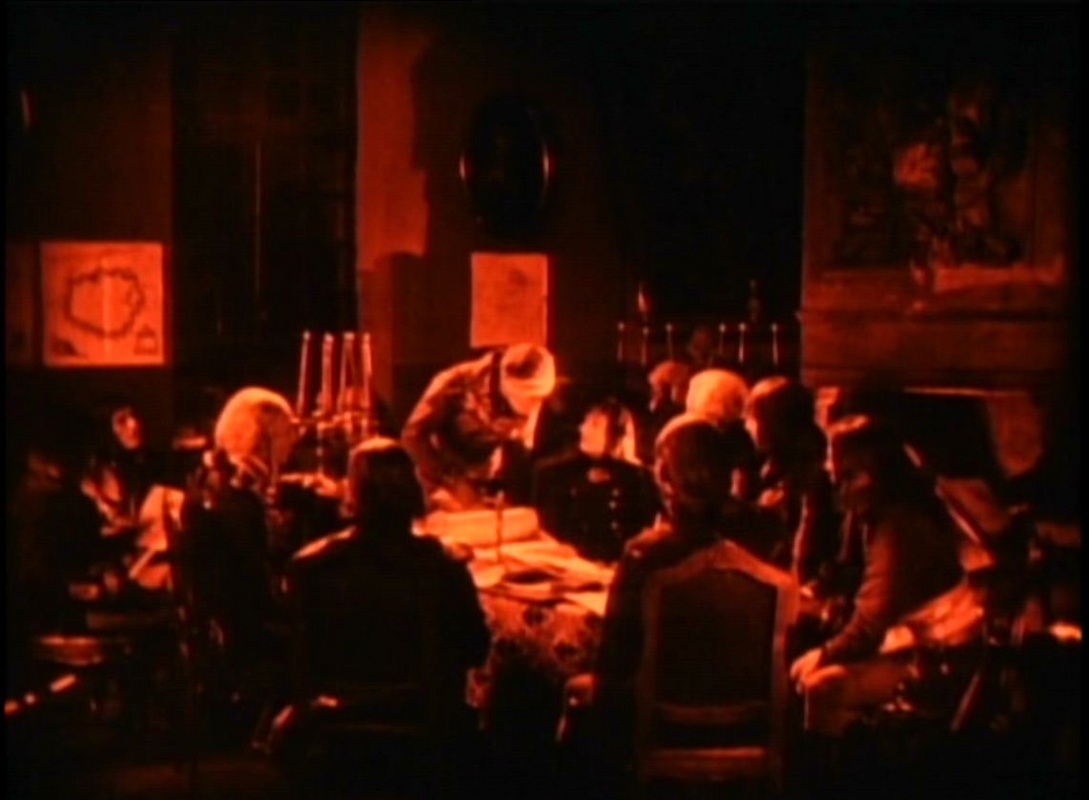
There is more in this sequence, related to the kind of map we are shown. This is a rare instance in cartographic cinema of a map actually being drawn in the mise-en-scène. The hand-drawn images correspond to the teacher’s attitude, allowing himself to give a personal interpretation of the places he maps in his own way. Such idiosyncrasy informs, more dramatically, a moment more than two hours later in the film, where Bonaparte, now working in the army's topographical office, presents his plans for a campaign in Italy. His hand-drawn map of Italy is received, enthusiastically, by his superior in a room displaying printed maps of that peninsula:
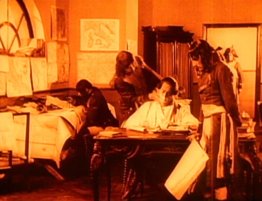
When passed on to General Schérer, the hand-drawn map is returned with Schérer’s hand-written comment: ‘these plans [both ‘plans’ and ‘maps’] are the work of a madman’.
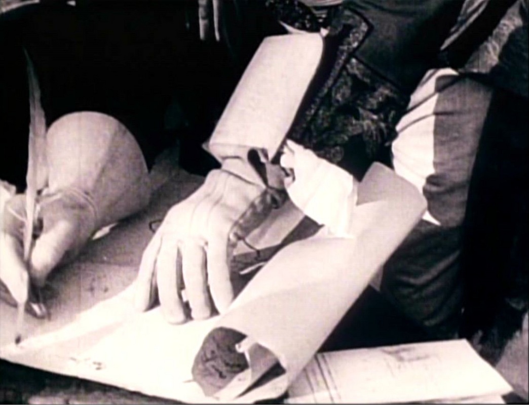
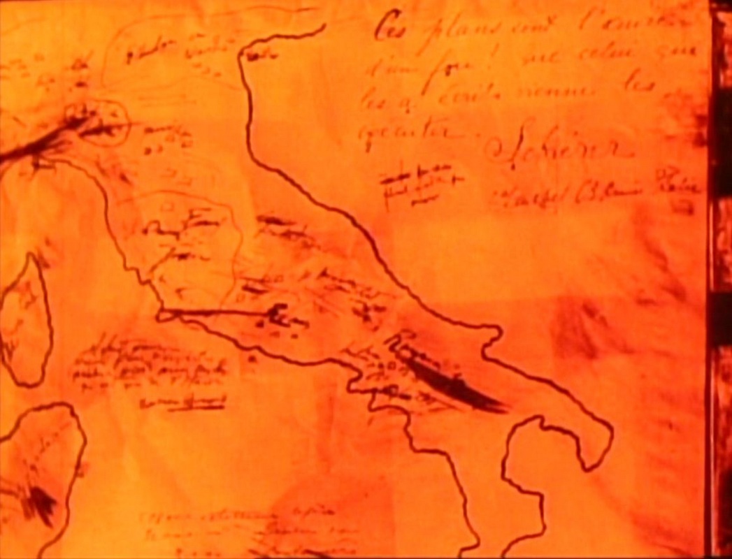
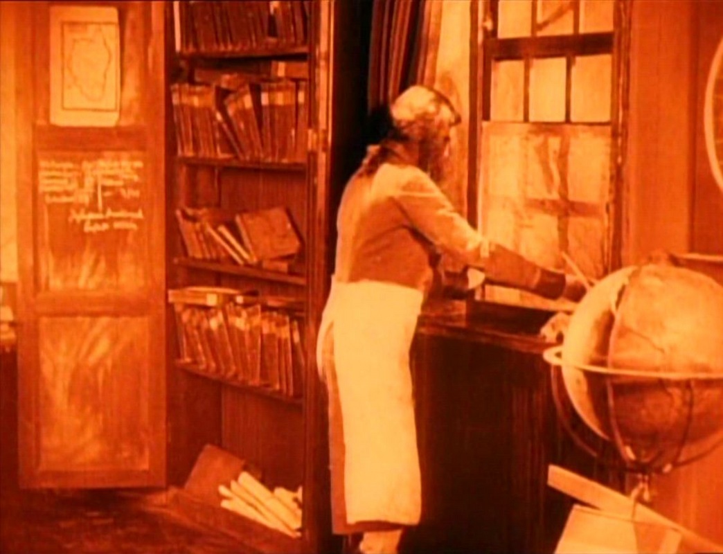
Rather than burn his map, Bonaparte uses it to patch a broken window, from where later he can retrieve it when given command of the army in Italy.
When we see this map a second time, we see more of it, including what had been obscured the first time: Corsica, exactly positioned west of Italy, a corrective to the topographical disorder of his schoolteacher’s mapping.
The return of this same map on screen marks a narrative shift, the progress in Bonaparte’s reputation as a strategist, as well as his passage from the margin to the centre. When he confronts his reluctant generals he has before him printed maps, a sign that his vision is no longer idiosyncratic.
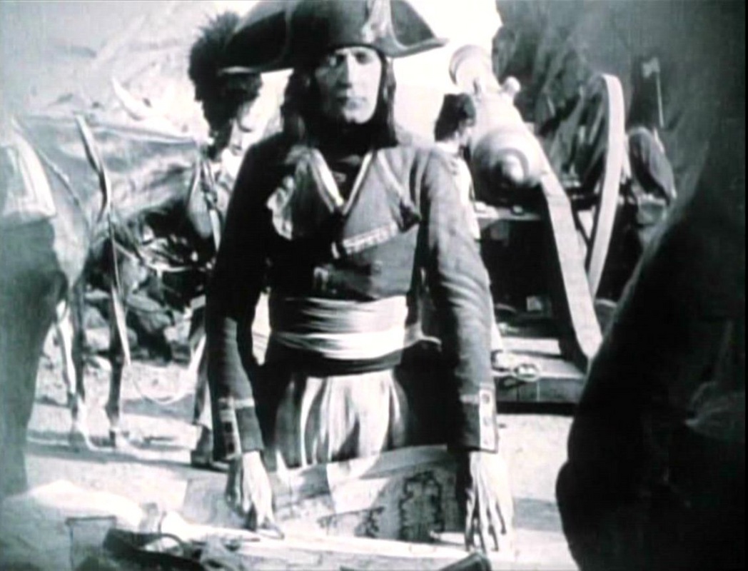
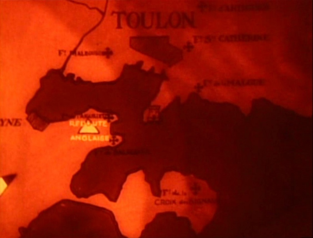
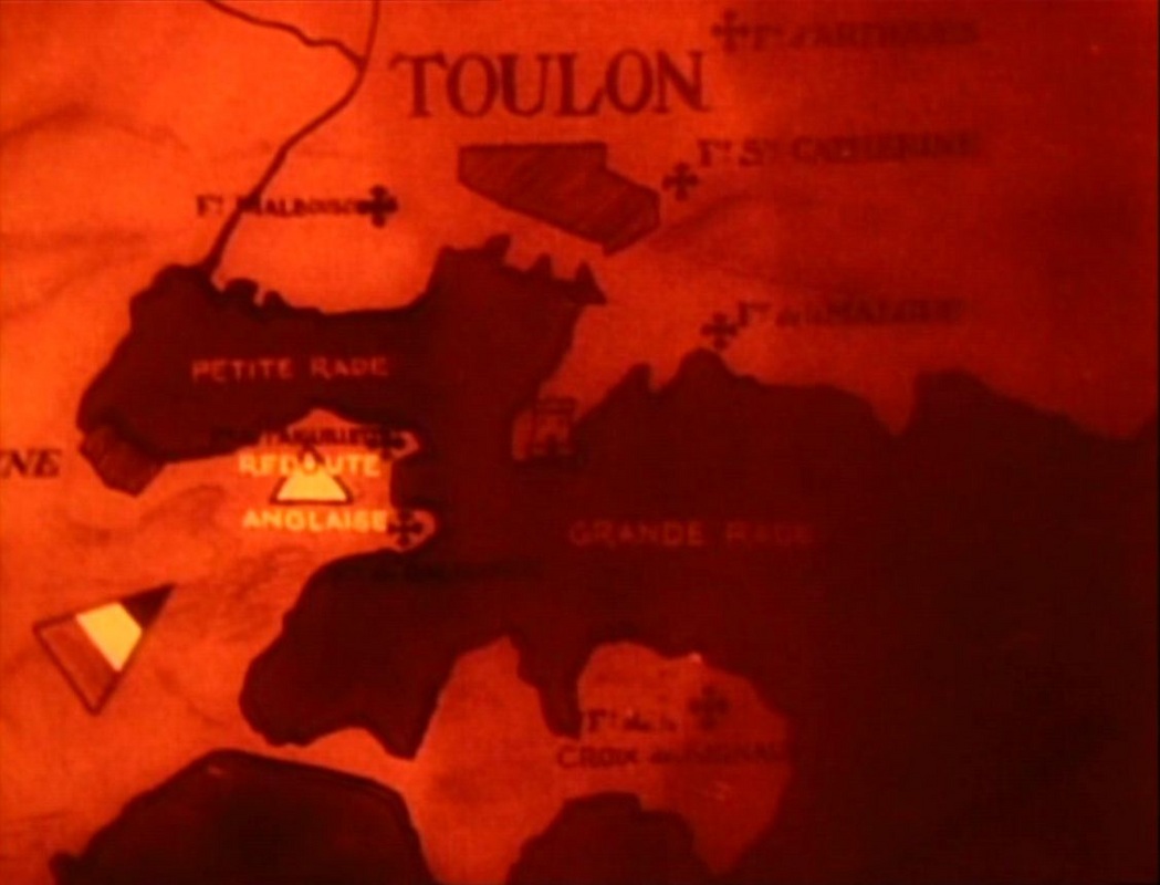
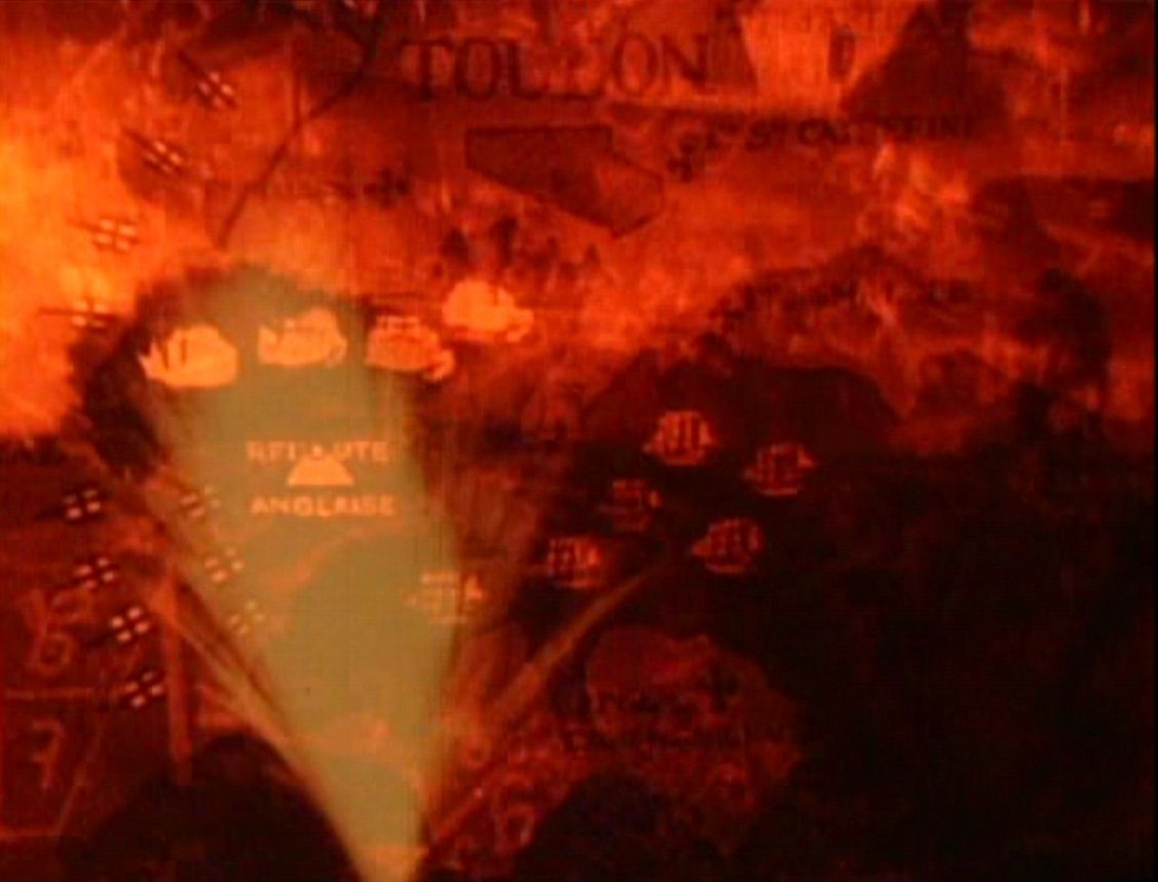
Before this apotheosis, Bonaparte is shown to have proved himself in the siege of Toulon, represented by Gance in cartographically spectacular fashion. Bonaparte is first asked by General Carteaux what we would do to take Toulon, and his plan is shown on the map through animated movements of emblems:
 |
 |
 |
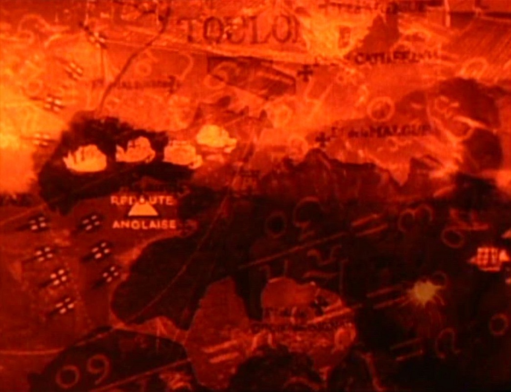 |
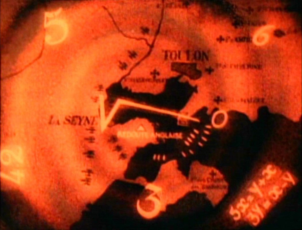
Carteaux ridicules the plan, and it is only later, when Dugommier has taken charge of the siege, that Bonaparte’s plan is put into action. Before the assault itself we have Bonaparte’s vision of the plan through a different graphic map, superimposing on Toulon several animated numbers and symbols that represent (I think) the calculations that had gone into the plan’s conception:
 |
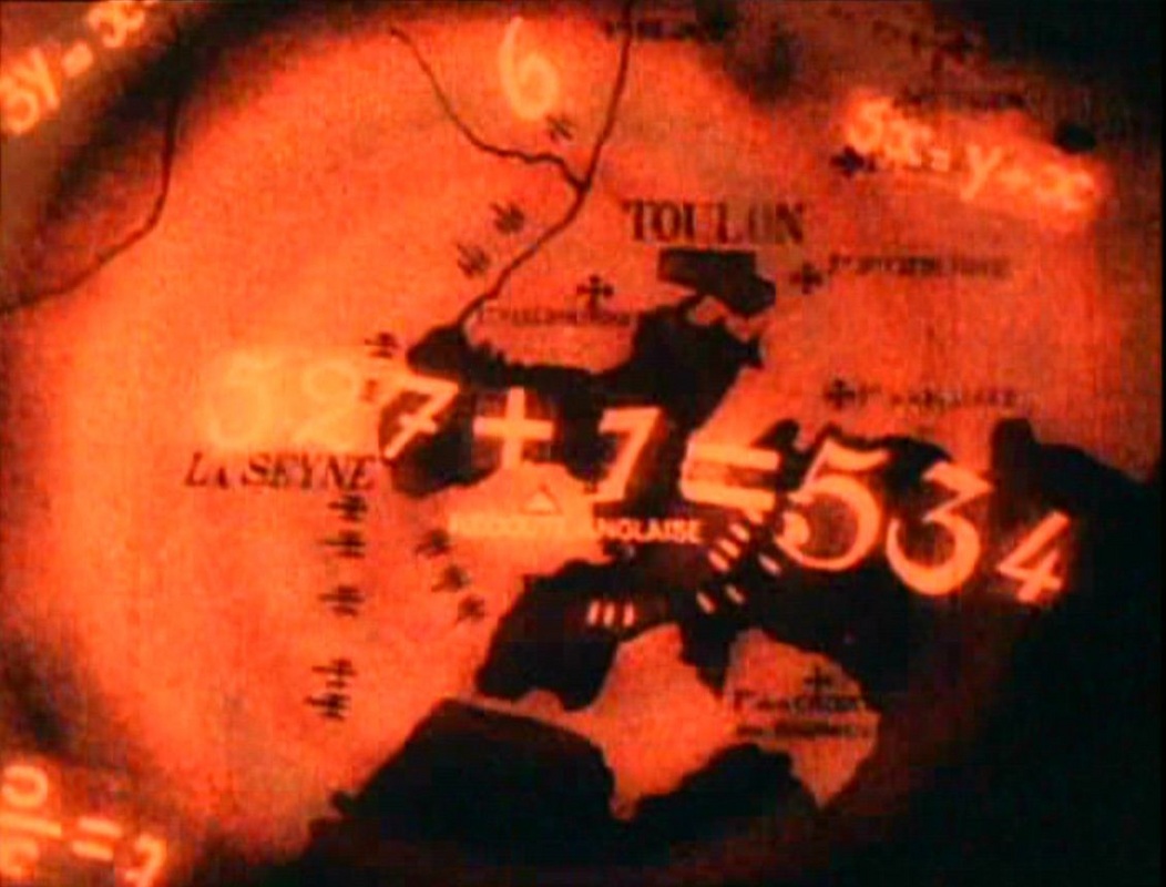 |
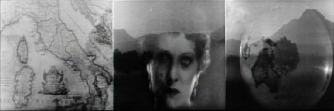
The film’s cartographic variations include recurring sights of a globe. In the schoolroom it is just part of the background and no attention is paid to it, but globes that appear in later scenes are more significantly positioned. In the scene where Bonaparte repairs a window with his rejected Italian plan, to the left is his map of Corsica, and to the right is a globe showing, in a dramatic contrast of scale, the Americas:
The same globe appears in other rooms occupied by Bonaparte, and a similar one is centrally positioned in the scenes representing Admiral Hood’s headquarters during the seige of Toulon.
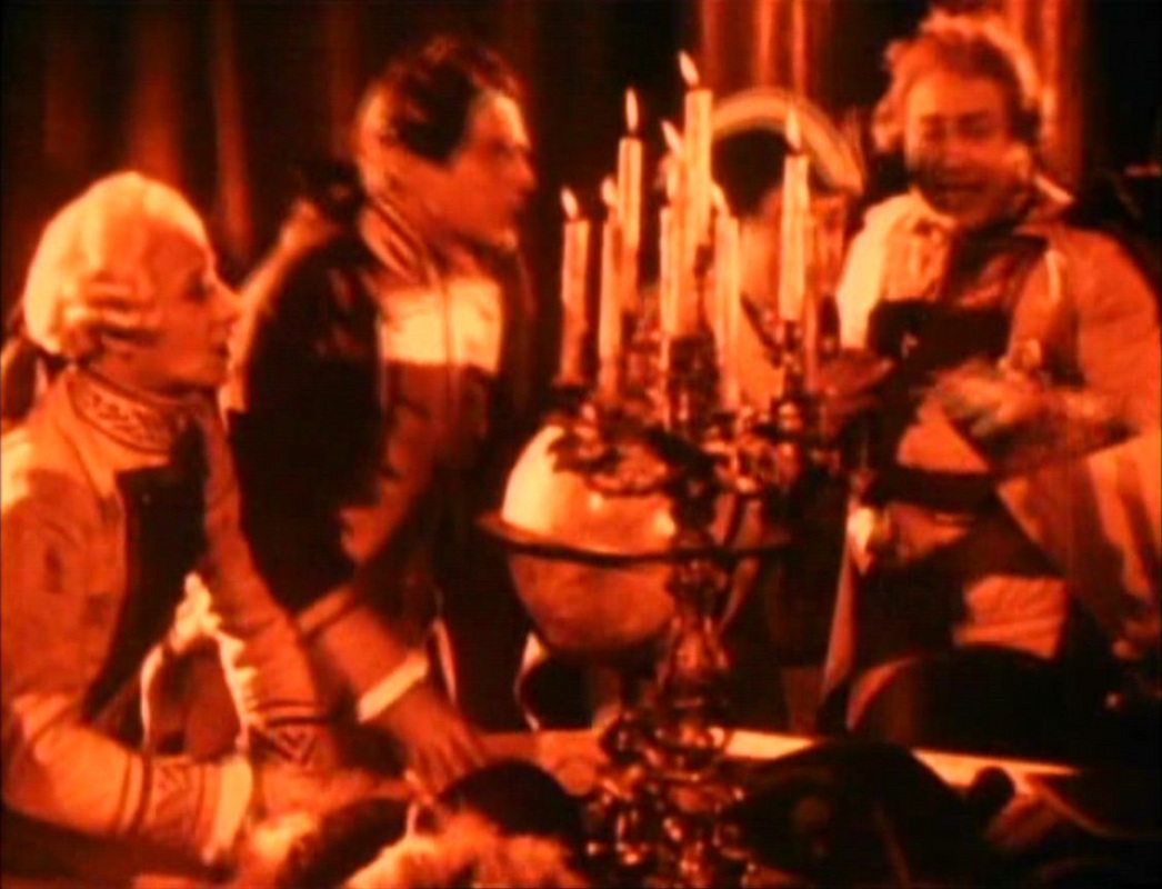
None of these is interacted with until a scene where Bonaparte kisses a globe and is asked by Talma, the actor who has been giving him lessons in courting: ‘Are you kissing Paris?’
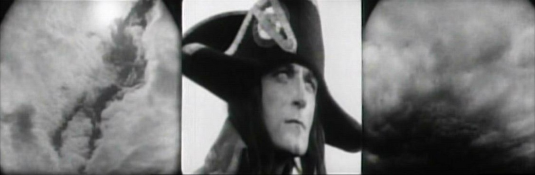
To which Bonaparte replies: ‘It is the mouth of Josephine’:
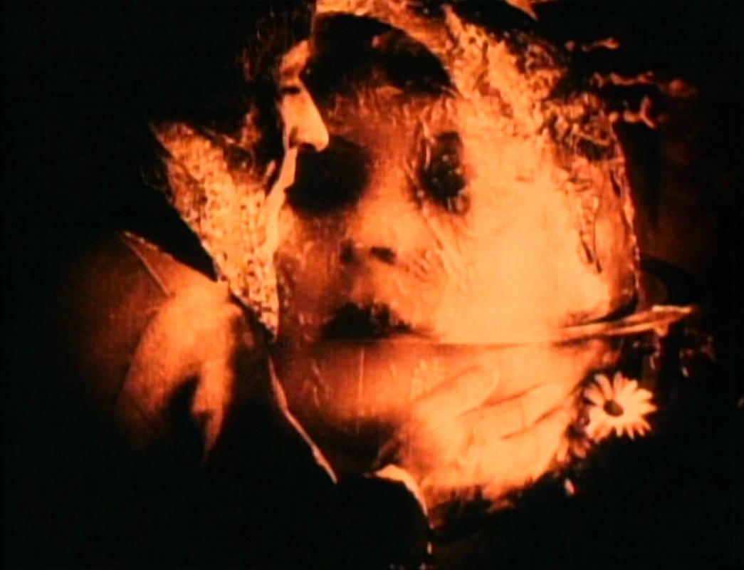
This spectacular superimposition of two objects of desire, Josephine and the world, presents in an obvious manner a private/public polarity. After Josephine has become Bonaparte’s wife, the collocation of her face and the globe returns within a more complex cartographic confection at the end of the film, as part of the fifteen-minute triptych sequence that brings it to a close. The first maps in this climactic sequence are a spinning globe and a map of Italy, in printed form this time, presented to each side of Josephine’s face, forming a ‘triptych of desire’:
For about thirty seconds these three elements occupy the sequence, each at moments fading out and returning, while on each are superimposed different fragments of action from the Italian campaign, including shots of Bonaparte contemplating the scene before him. Moments later the elements of this triptych are brought together in the central panel, while to each side the military action is shown more clearly, without superimposition.
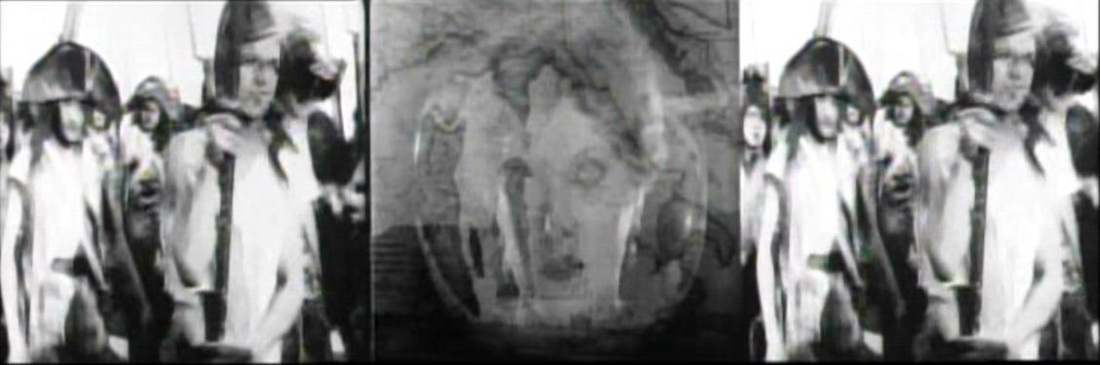
The four superimposed elements in this central panel - the face of Josephine, the turning globe, the map of Italy, and the silhouette of Bonaparte - do not appear quite as confused in the film, where movement helps to differentiate them, but the confusion nonetheless signifies, contrasting not only with the simple shots of soldiers, but also with what is to come in the sequence, centred on Bonaparte's face rather than Josephine's.
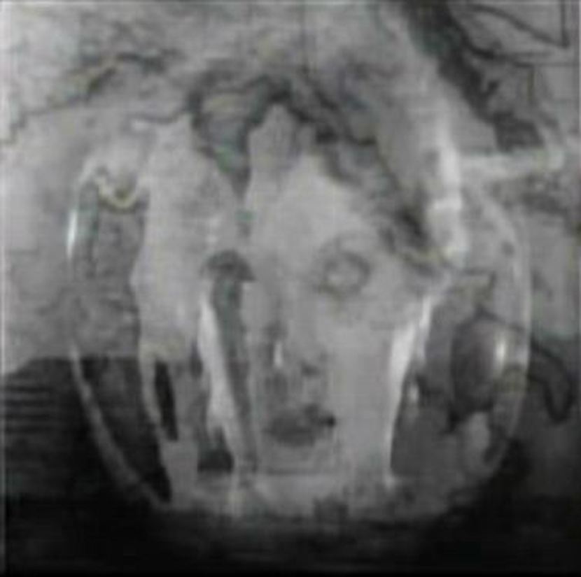
The sequence becomes domininated by what Maureen Turim calls ‘recapitulative flashback’, in which maps still figure but as signs of things remembered, so that on the map shown here, beside the young Bonaparte’s face, Corsica is as important as Italy:
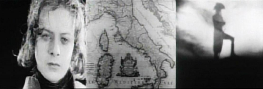
Memories of his victory over the English at the the siege of Toulon also appear in map form:
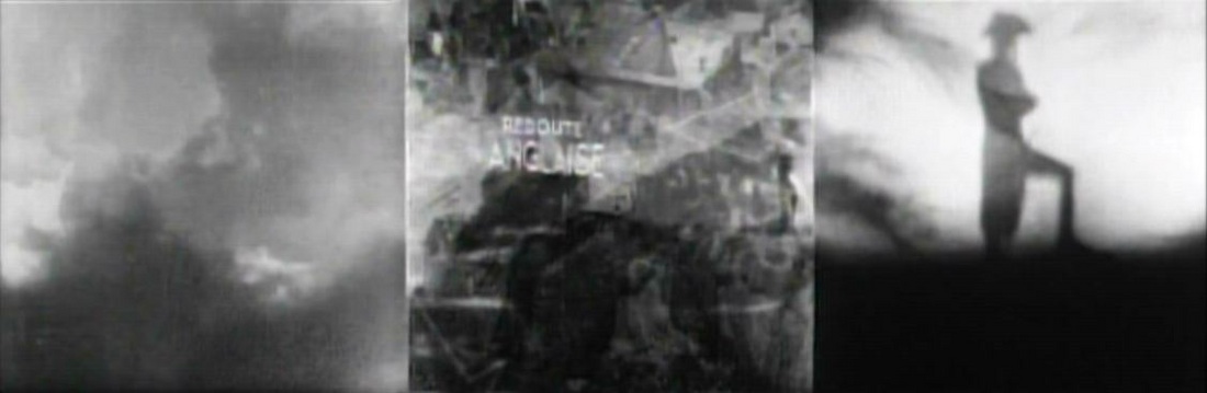
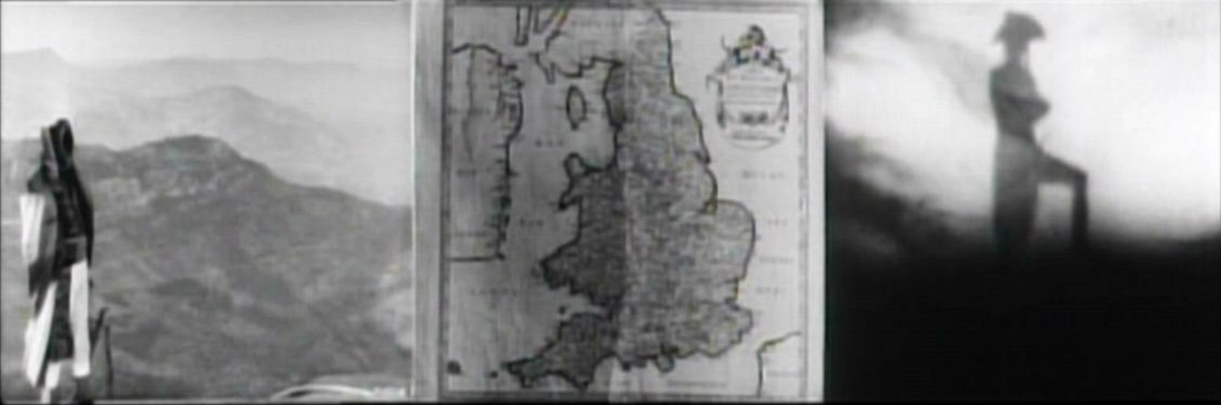
Some maps in the triptych sequence evoke the past (Corsica, Toulon), some point to the present (Italy), and the spinning globe announces a future in which Bonaparte will bestride it. In the midst of the maps remembering Toulon appears a map of England, twice, reminding us (somewhat unnecessarily) of the enemy at Toulon, but at the same time pointing to the future, in the manner of the reference to Saint Helena in the film's first cartographic sequence. England will be Bonaparte's nemesis, and that we are shown this country's outline so clearly, without superimposition, suggests that we should not forget it.
(I have not discussed all of the maps to be seen in this film, notably a map on the wall of the French headquarters during the siege of Toulon perplexes me. If anyone recognises the outline of this island I would much appreciate hearing from you. Furthermore, I have used the 225 minute Zoetrope/Brownlow edition for this piece, and I don't doubt that there are many more interesting maps to be discussed in Kevin Brownlow's more recent, 5-hour restoration (see trailer here). When I get a copy of that version, I shall revise this piece accordingly.)
(With thanks to Mitchell Sams for help with this piece.)