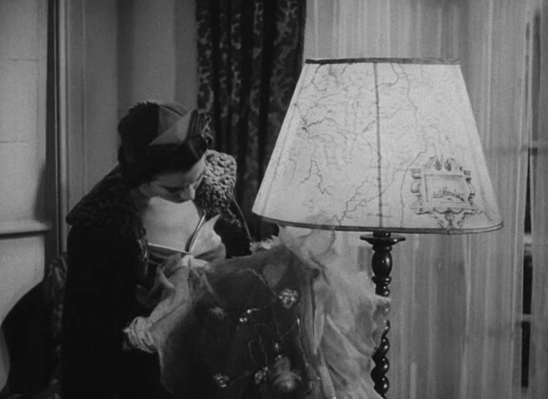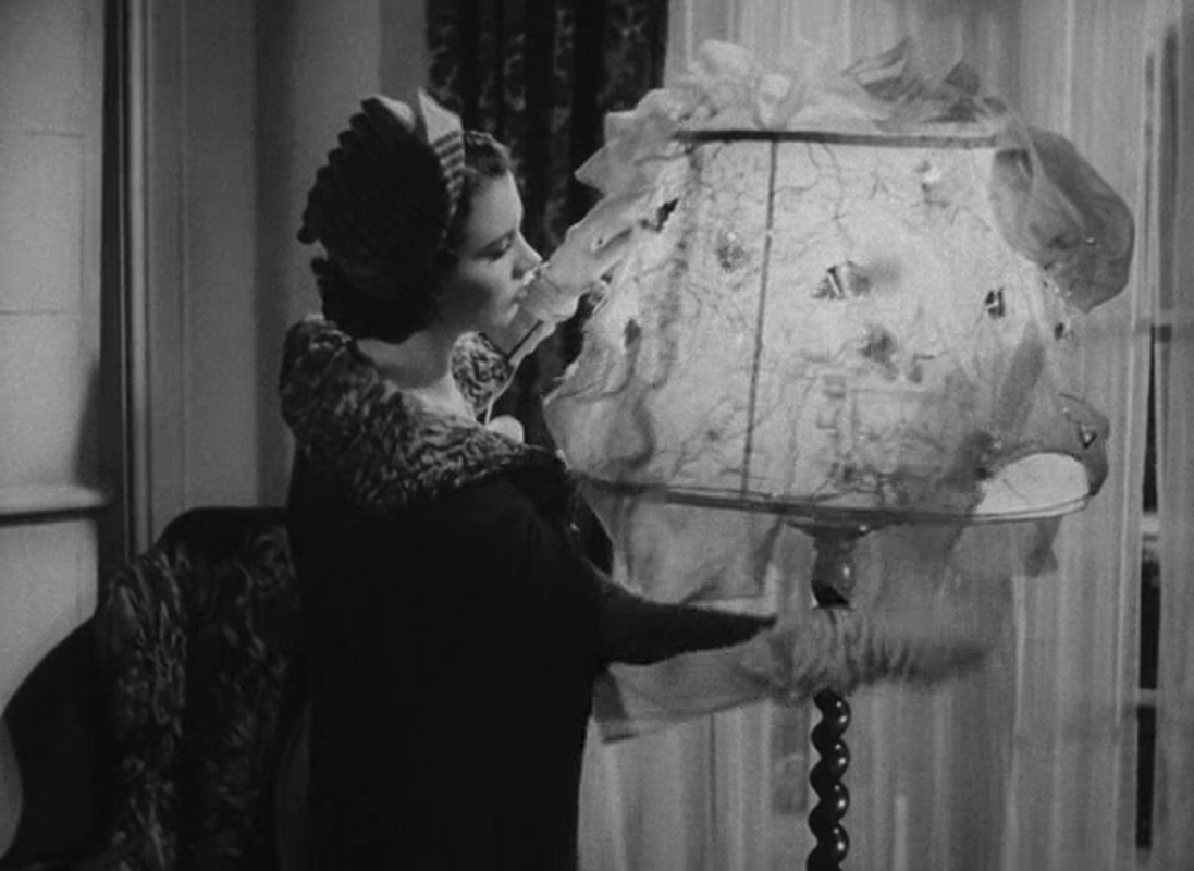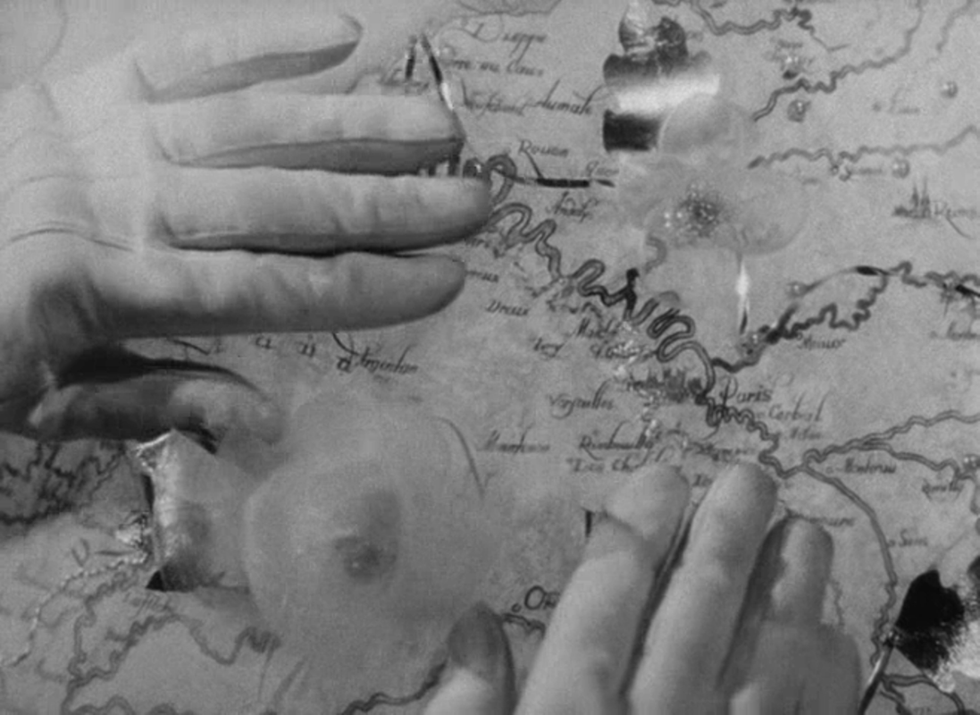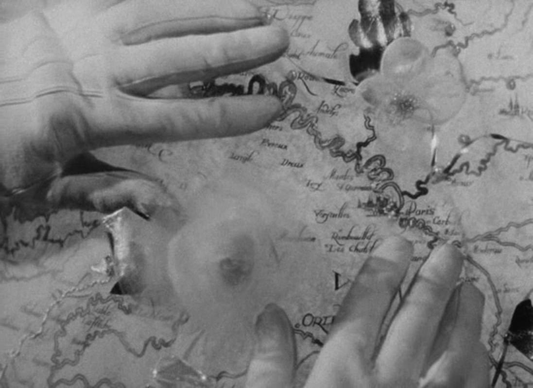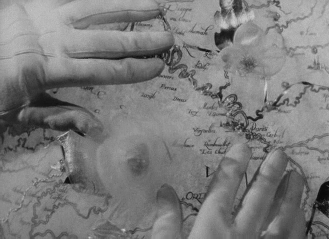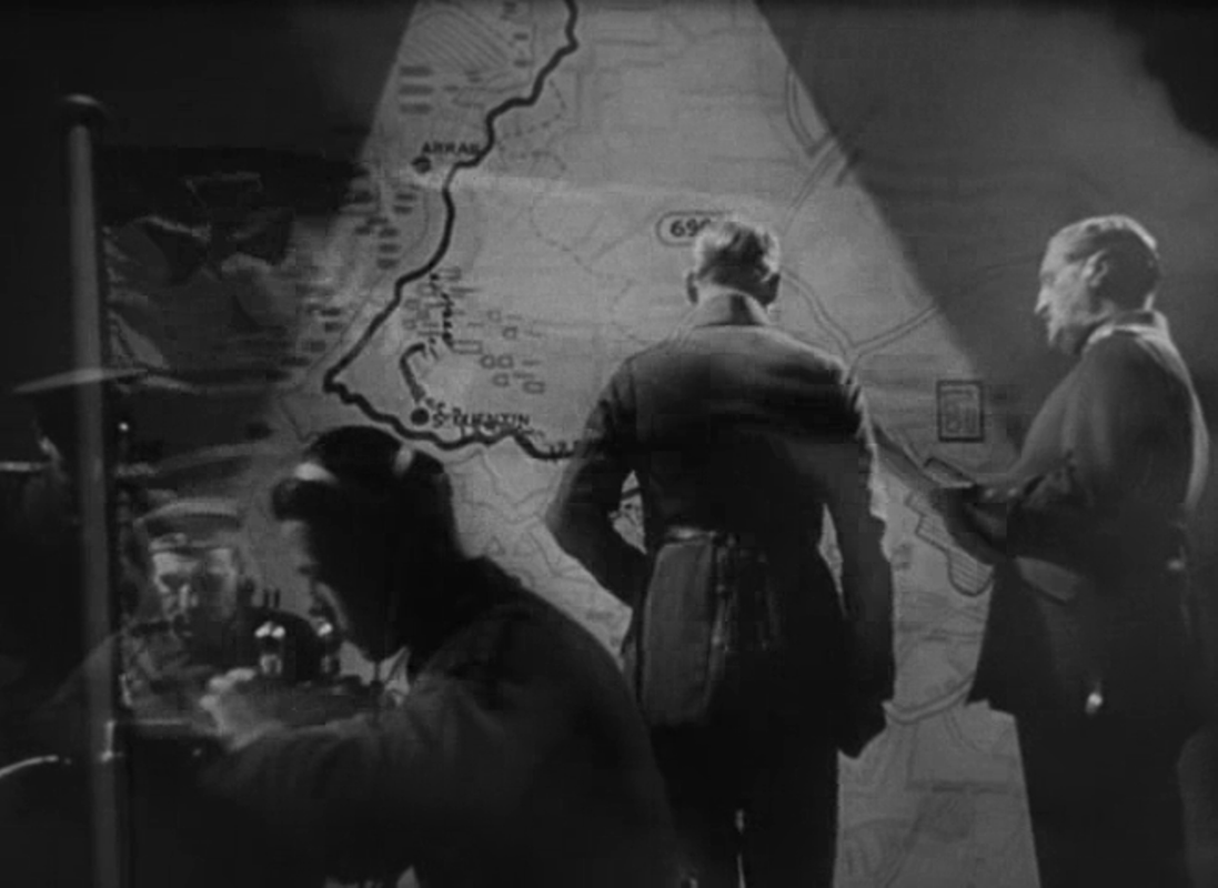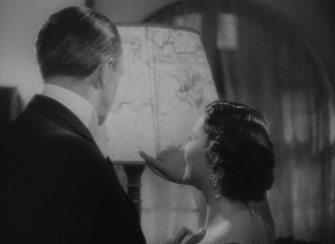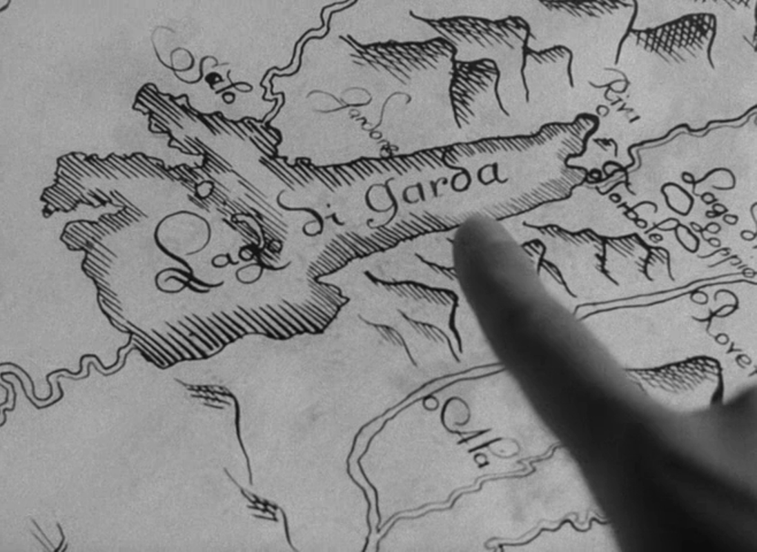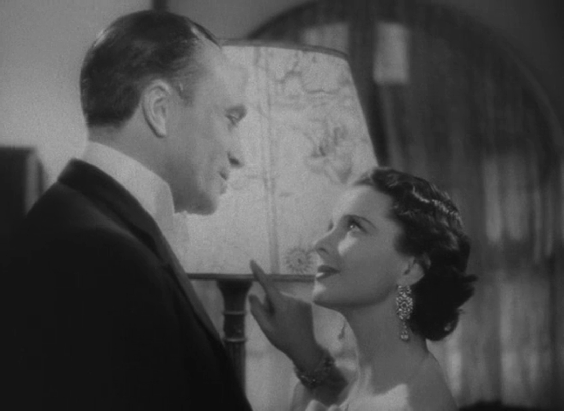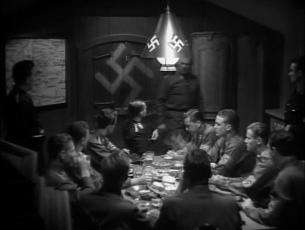
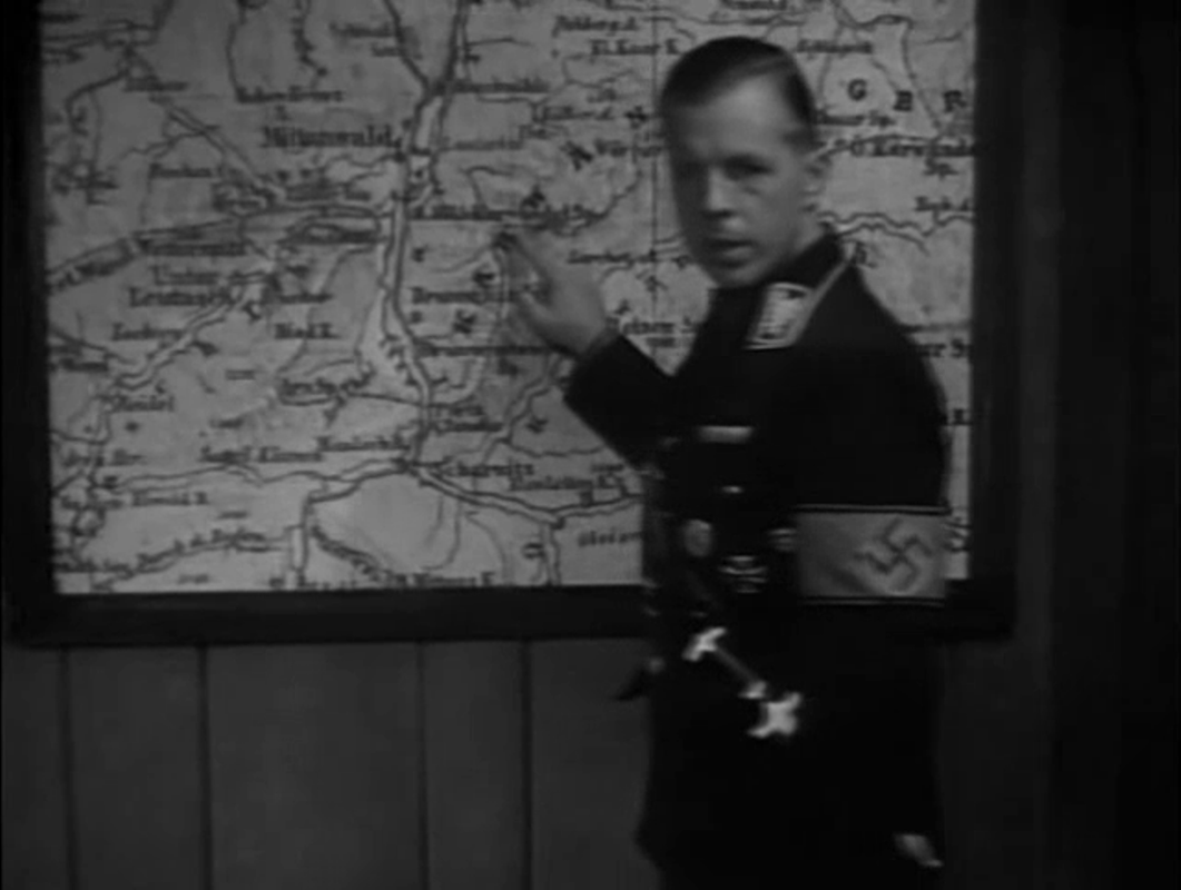

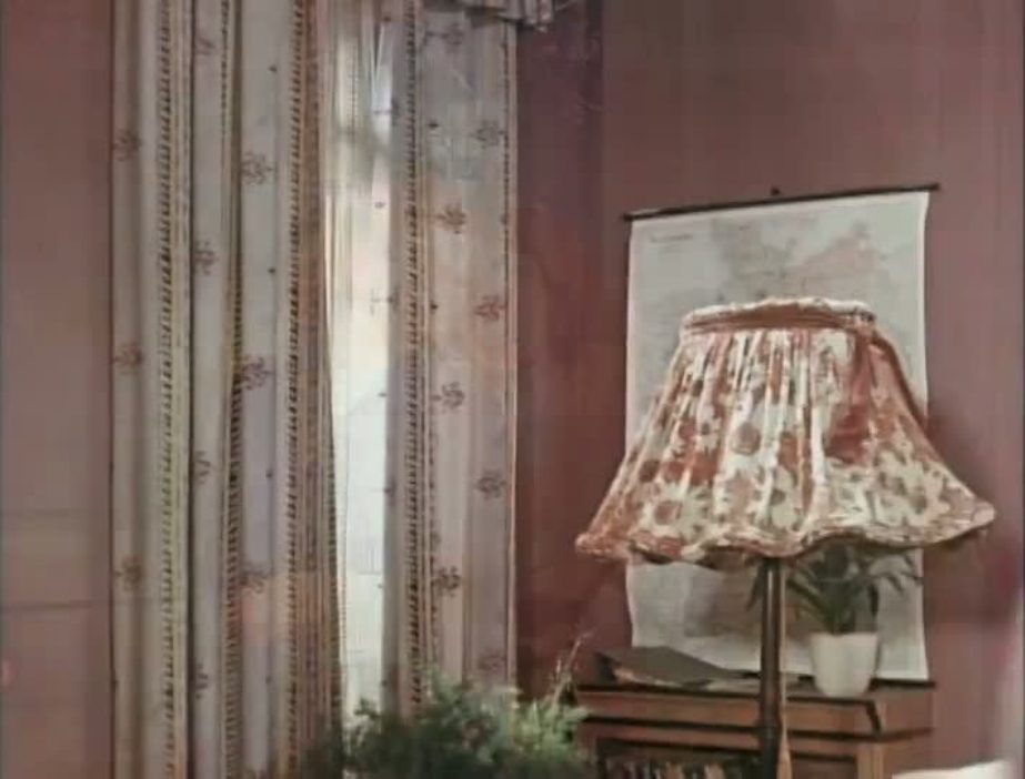
   The idea of a map, one showing the separation of East and West Berlin, is central to the film, but the only map suggesting that idea is this, on which at one point the line separating East and West Germany can be seen.    This map of Germany is in the room of a West Berliner whose seductions of women is the principal plot motive. In the room of the film's heroine, a law student who recovers from being abandoned by the seducer to become a high court judge, there is a globe: 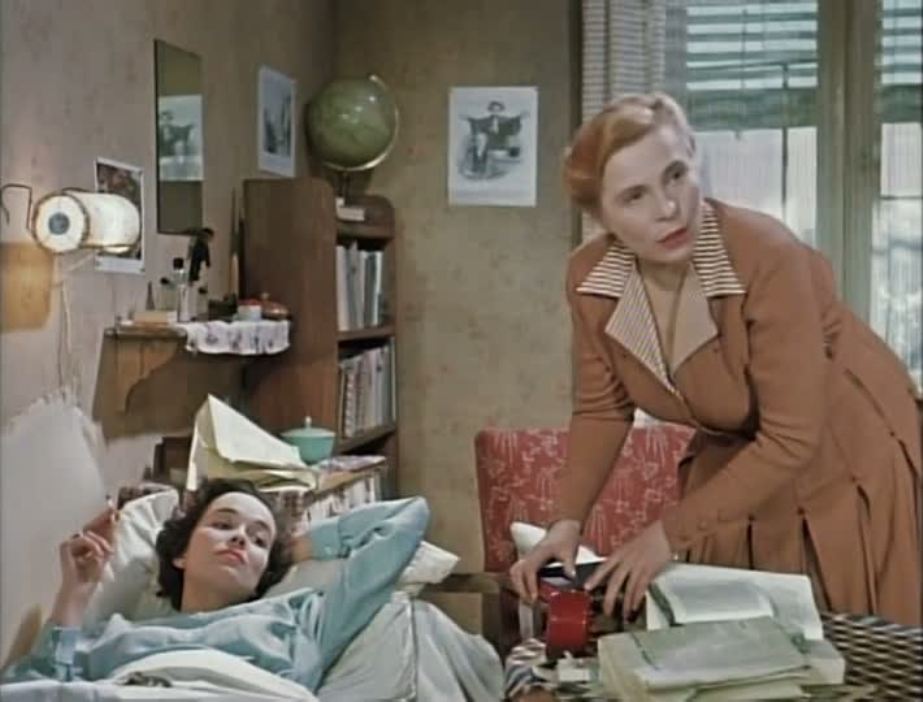  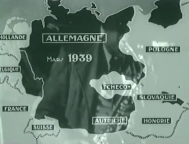 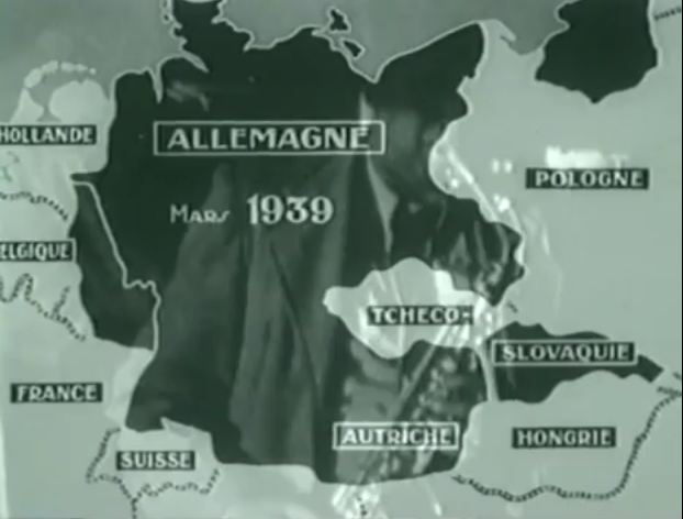 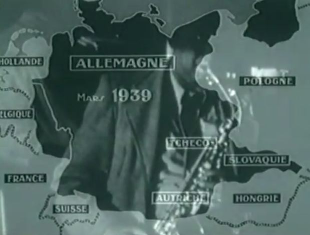  Laszlo Strausz, 'History as a Palimpsestic Narrative in The Danube Exodus', Film-Philosophy 15.1 (2011). p.101. The cine-maps in The Danube Exodus operate at Strausz's first narrative level, seeming to create an objective narrative situation. The superimpositions, however, hints at the imminent disruption of that naïve conception. You can read the whole of Strausz's excellent essay here, in the latest issue of Film-Philosophy.        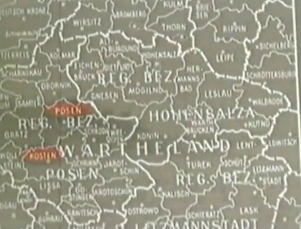    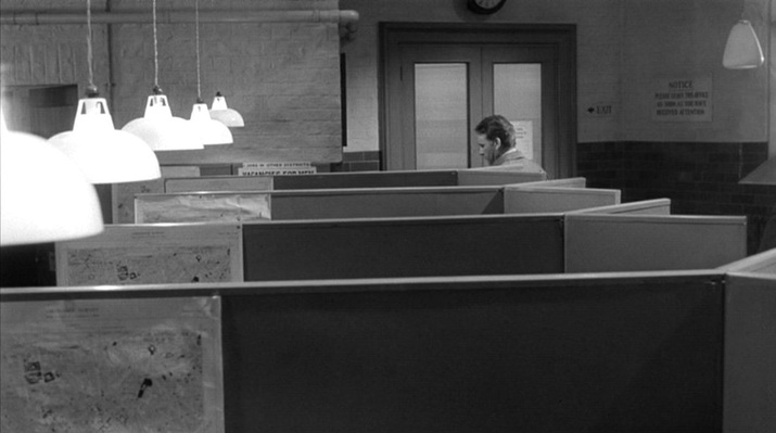 There are maps in only two places in this film. The first place is a Battersea Labour Exchange, where every one of the five cubicles we see has the same map of a section of London (the S.W. districts around Battersea). The maps are presented individually as Leamas (the protagonist) passes, then in a serried rank. 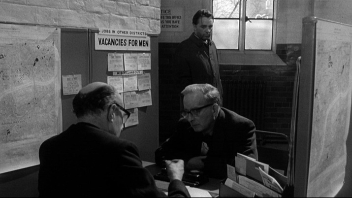 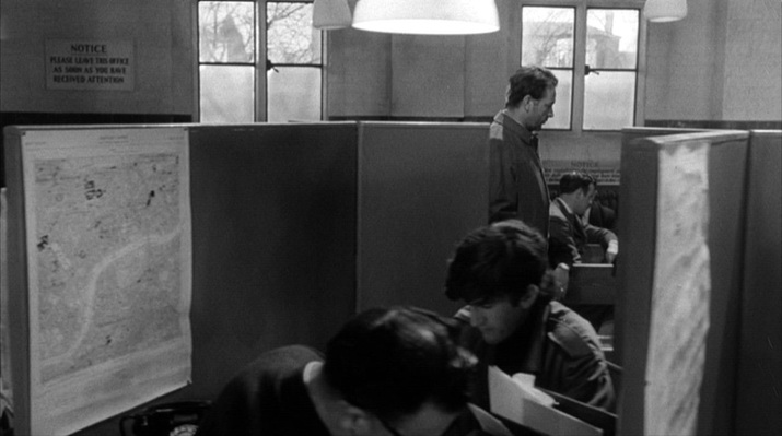 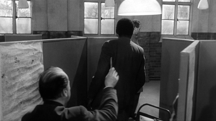 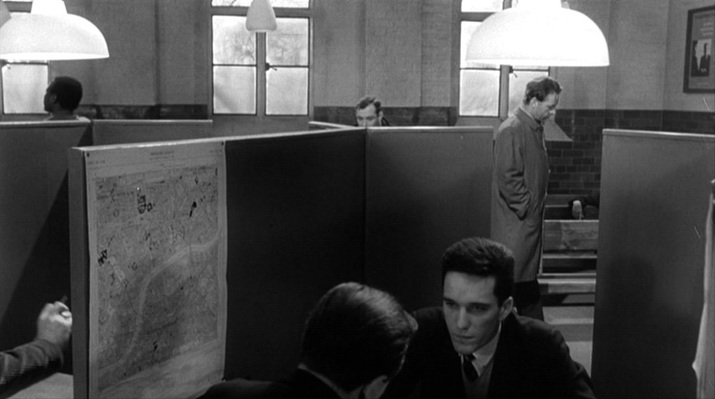  This is a uniform, regimented environment, but the cubicle to which Leamas is summoned has its map placed out of line (and the lamp above it is a little dimmer), hinting at the difference in the treatment he receives (he is sent to a job in a library as part of a convoluted plan hatched by the Secret Intelligence Service). The other place with maps is a room in East Germany where an in camera tribunal is being held: 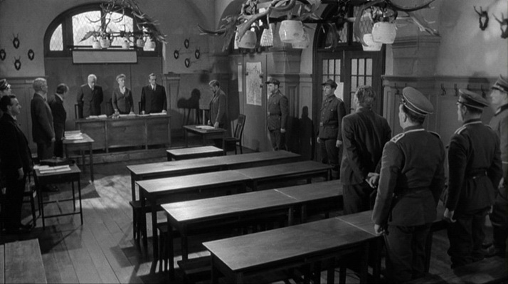 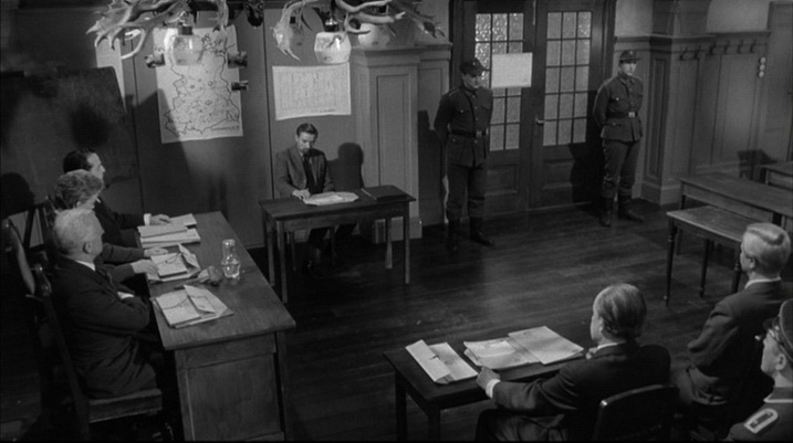 There are two maps in this room. One is of the DDR, and is very distinctive. It is drawn to demarcate specific but (to me) unfamiliar sectors of interest, and looks as if it should be in an operations room (pinned to it are photographs of motor cars, and it is inscribed 'Unternehmen 212', which I cannot gloss). It is also remarkable because it shows nothing of what is around East Germany, as if it were an island: 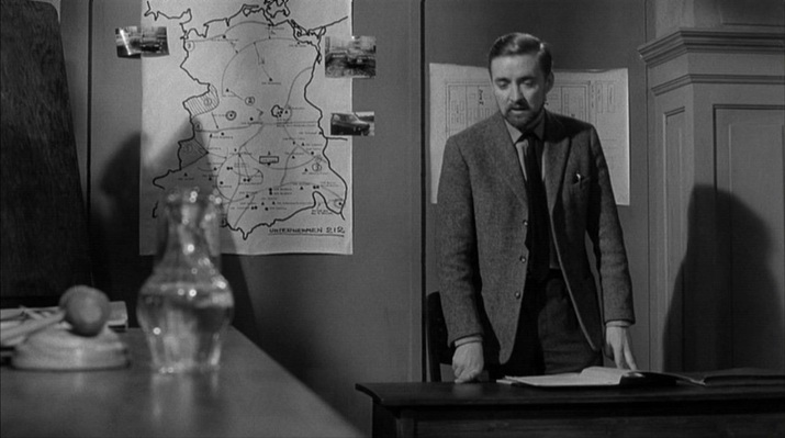 The second map is of a set of buildings, the camp to which Leamas has been brought. It is inscribed Mühlberg/Elbe, the location of the German prisoner of war camp Stalag IVB which - significantly for the film's thematic of shifting loyalties ('availability') - became a notorious Soviet internment camp immediately after WW2. 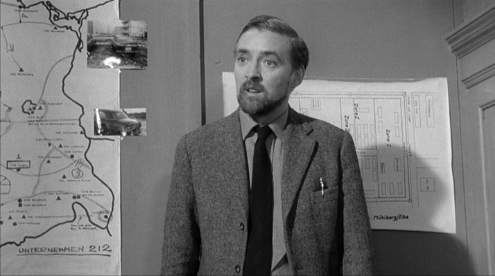 The mapping of the film's London locations poses certain problems. A sequence in which Leamas is trying to ensure he is not followed shows him in different parts of London: Fleet Street, South Kensington Station, Gloucester Road, and then his destination, the residential street we see here (as yet unidentified): 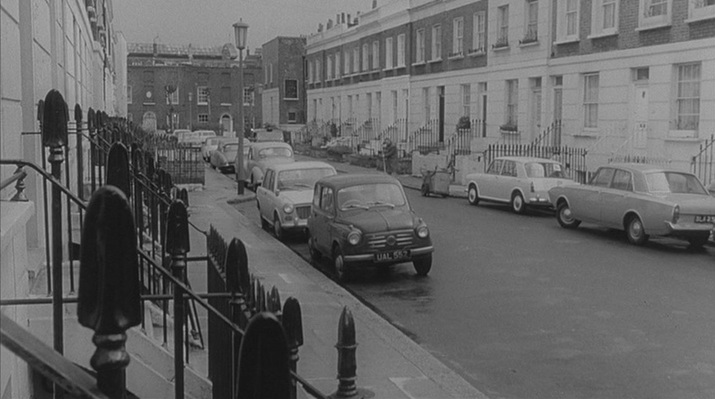 Leamas is here away from his usual territory around Battersea. His address is Falcon Road S.W.11, he meets a secret service contact in Battersea Park, and when he goes to the Labour Exchange, the official suggests a job at Battersea General Hospital, then sends him to an address nearby (Candahar Road). He points to the location on the map, but his fingers are the wrong side of the river entirely: 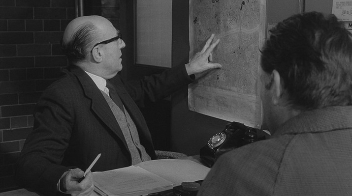 No one should be looking so closely as to to be troubled by this solecism. More troubling, anyway, would be the fact that the Labour Exchange itself is topographically compromised. It is supposed to be in Battersea; on the way there Leamas passes a tattered poster indicating as much: 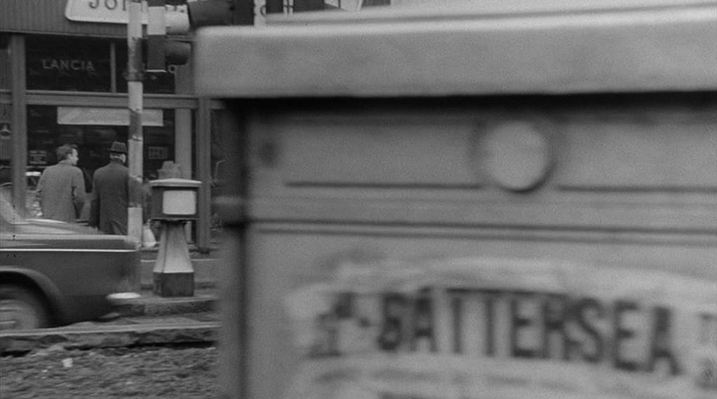 However, this exterior is not in S.W.11 but across the river in W.2. Here, from the Reel Streets site, is the evidence: 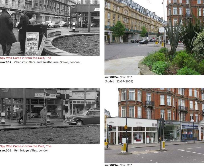 The film as a whole was always going to be topographically compromised, since the scenes set in the DDR would have to be filmed elsewhere (Ireland, in the event). So having one part of London pass for another is hardly serious.
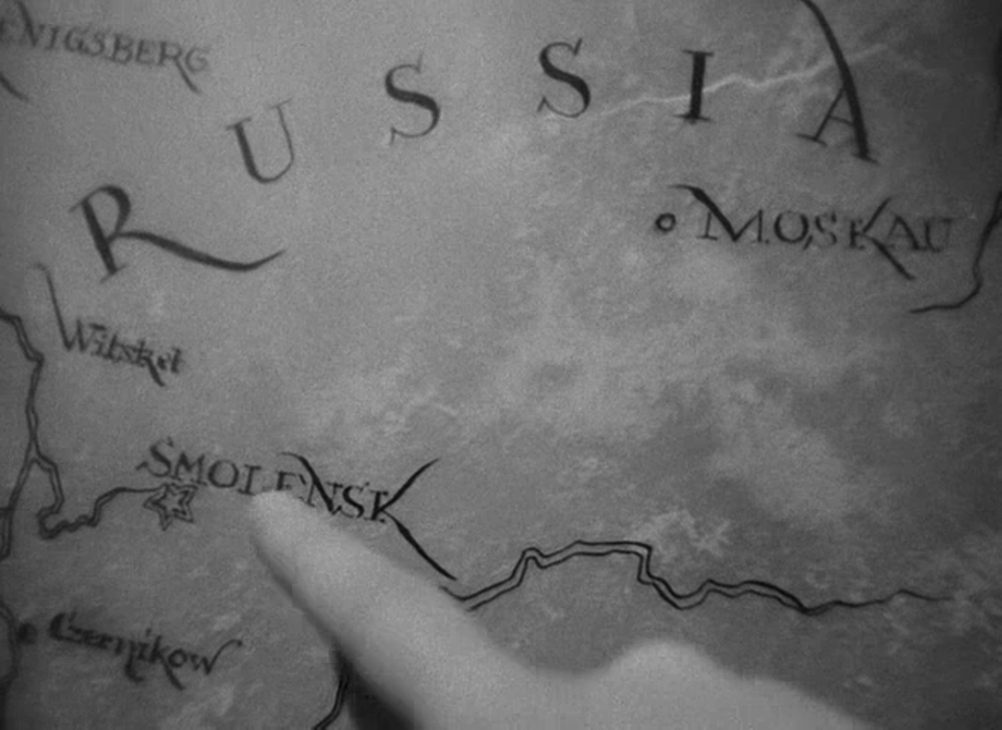
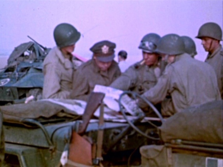 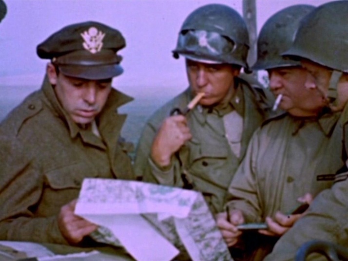 This is a rare occasion where a map appears in the footage shot by George Stevens Sr. Episodes in this compilation are linked by cinemaps: 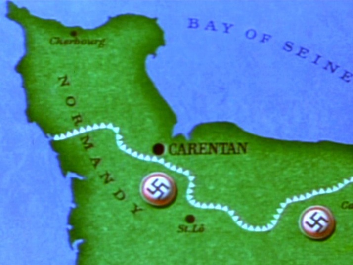         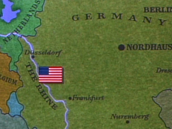 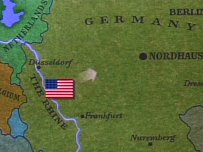 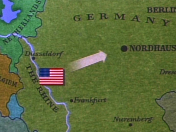 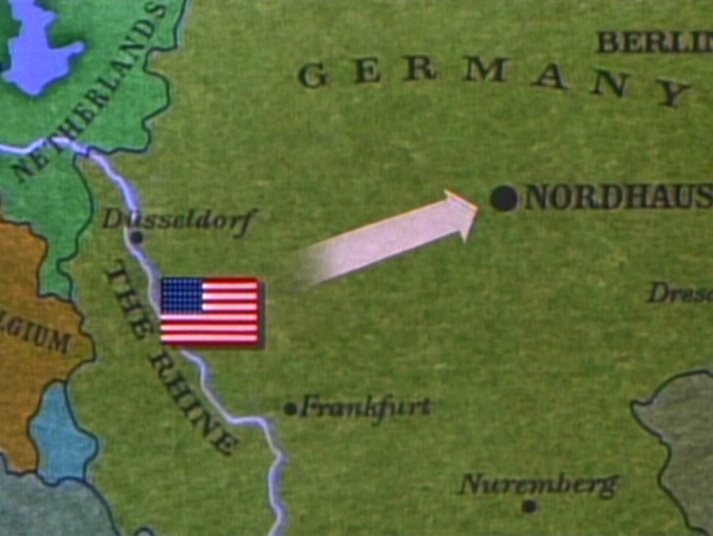 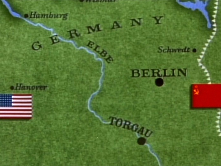 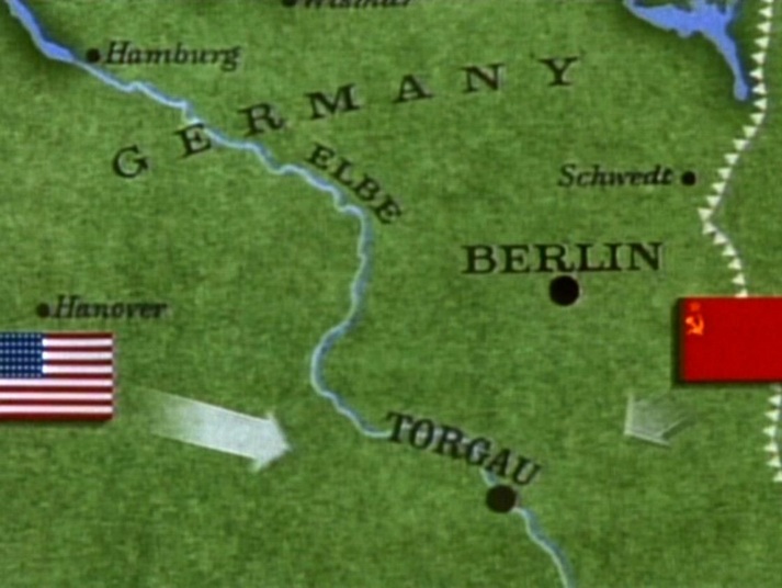 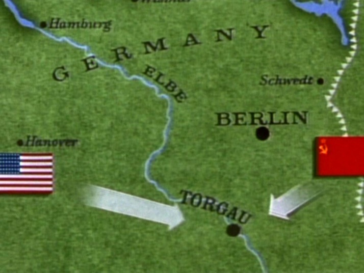 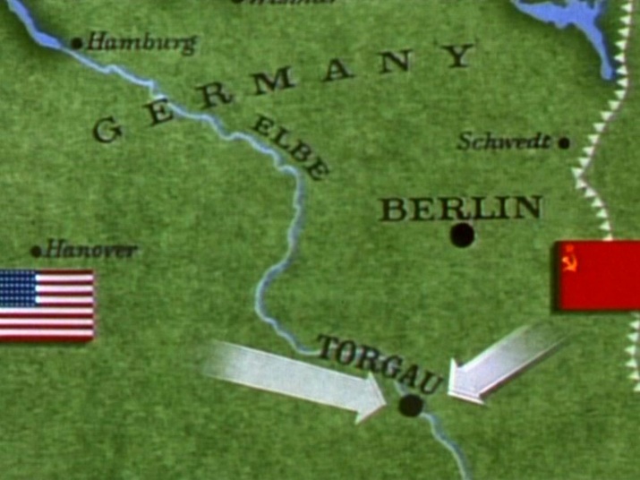 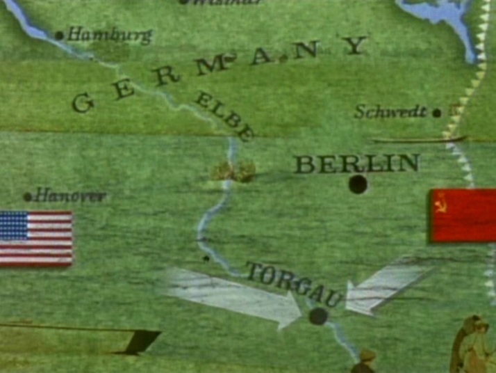 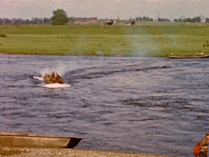 The climactic meeting of Americans and Russians at the Elbe is marked by a cartographic representation in the mise-en-scène: two soldiers standing on a globe. 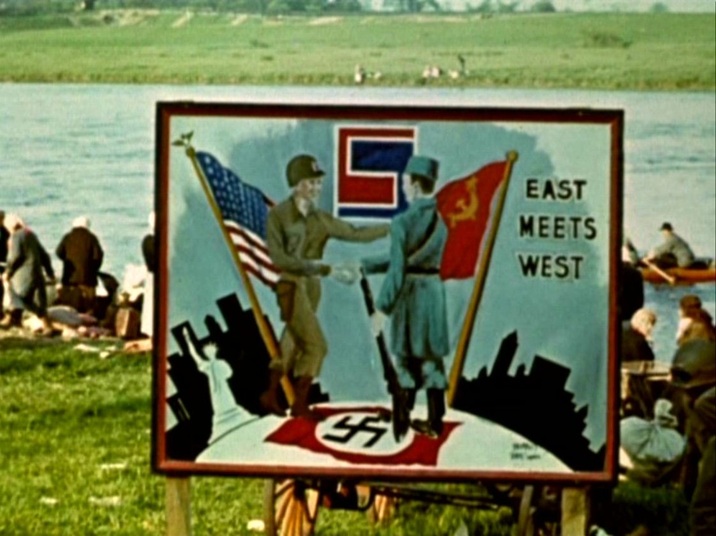 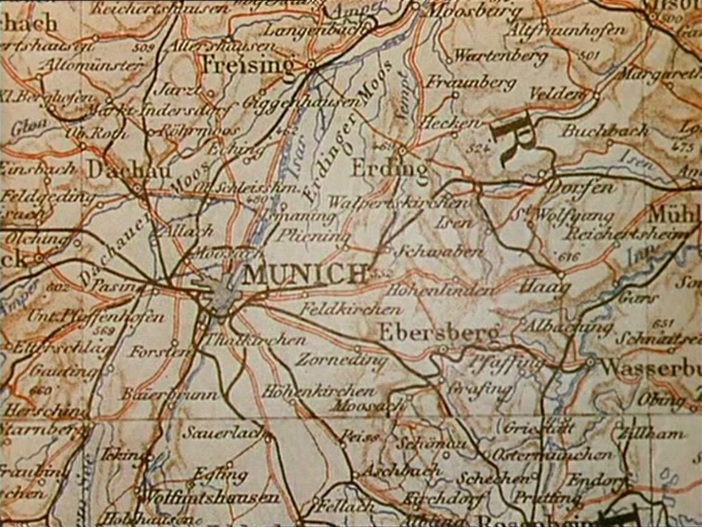 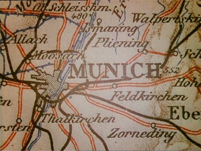 ‘The evasion of reality is marked by Clive's two- dimensionalisation, as his substantial form is replaced on the screen by an ephemera, a walking shadow, an apposite nod to Macbeth, perhaps, for consequent upon the loss of his love, Clive's hunting life is a sound and a fury, a rampaging safari, signifying nothing. A similar montage immediately after the death of Clive's wife Barbara reinforces the point. Its status as a denial of historical progress is made clear as this second speeded journey through the inter-war period culminates in 1938 with a map of Munich and strains of the German national anthem. Clive later hangs Barbara's portrait in the 'den' along with his other trophies, emphasising what is now clear. It replaces, rather than proves, virility, and undoes Clive's self-appointed status as masculine epic hero.’ Andrew Moor, Powell & Pressburger: a Cinema of Magic Spaces (London: I.B Tauris, 2005), p.75 A 'Map of Lower Egypt and the Fayum' is the background to a scene from the time of Clive's 'masculine epic heroism': 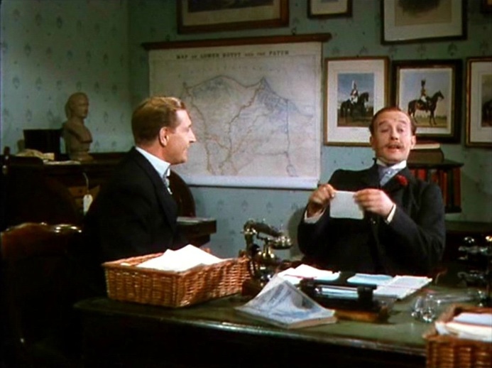 Maps of London are in the foreground of the events that will lead to his final emasculation: 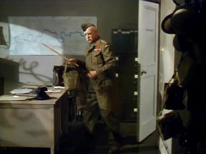  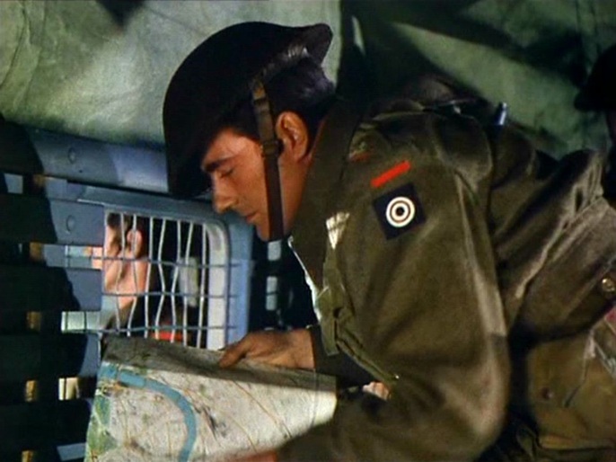 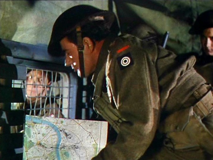 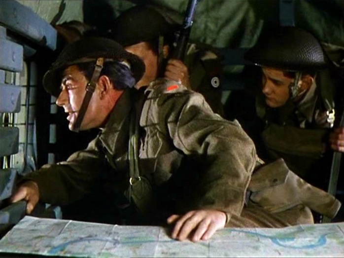 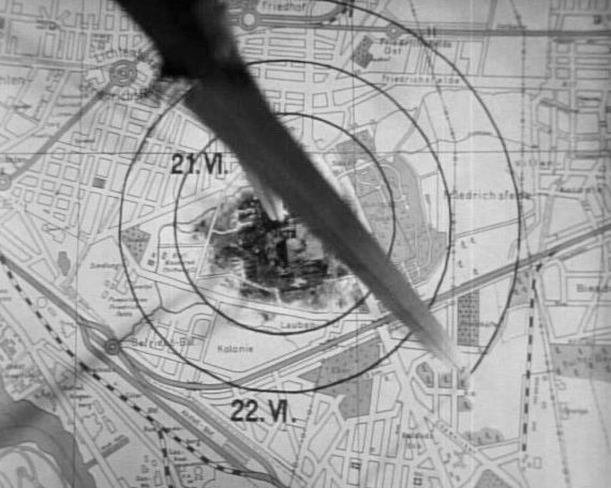 'Two shots angled have been used for this map, which refer to the two perspectives that have dominated cartography historically: (1) the oblique perspective – or “perspective militaire” – has been widely used by artists since the Middle Ages, to represent landscapes. (2) The vertical perspective or bird’s eye view characterizes the more modern and scientific representation of Earth. These two subsequents views of the same map capture the passage from a classic to a more modern perspective in cartography.'
Sébastien Caquard, 'Murder and Modern Mapping', (e)space & fiction |